
By Richard Budden, General Manager, Europe at Esri
Dubai Municipality and Dubai Building Permit Development Committee Launch New Strategy for BIM Across the Emirate
A new strategy for Building Information Modelling that enables a faster and more efficient building permitting system was announced this week at the BIM Middle East and Cityscape Global events. Dubai Municipality, as part of the Dubai Building Permit Development Committee, launched the strategy with the aim of consolidating permitting systems across the committee, standardising regulations against which buildings are validated, and reducing manual code checking and data entry.
A key aspect of the strategy will be enforcing the existing government mandate for consultants to use Building Information Modelling, or BIM, as a process and toolset for planning, design, construction and management of buildings and infrastructure. This mandate has been in place since 2015 but will soon be enforced, together with a new set of BIM standards that will be developed by the committee.
The new standards are planned to be rolled out in 2020.
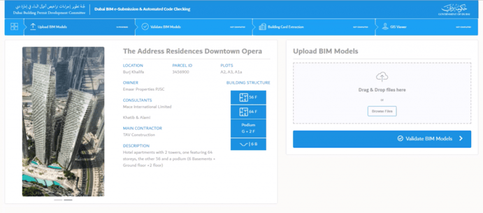
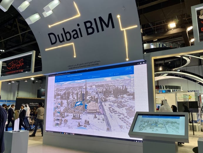
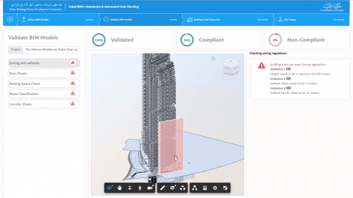
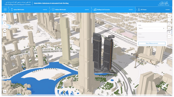
At Cityscape Global in Dubai this week, Dubai Municipality and the committee were showing their newly developed e-submission and automated code checking prototype application. The tool, developed by Esri and partner MG AEC Technology Partners, in collaboration with the Dubai Municipality GIS Centre, supports the complete workflow for code checking and permitting:
Through the implementation of this new strategy, the committee also hopes to increase the country’s World Bank Ease of Doing Business score for dealing with construction permits. The UAE is currently ranked fifth in the world.

