As the popularity of reality capture grows among both horizontal and vertical construction industry enterprises, UAVs, laser scanners and most importantly, the photogrammetric and/or point cloud data they generate, continue to lead the pack as the go-to technologies. It’s easy to see why:
Laser scanners, such as the Leica BLK provide an unprecedented ability to capture and document “as is” conditions with precision and efficiency. They’ve also evolved in a way that allows virtually anyone to use them.Despite the myriad benefits, there is still some hesitance among Civil and Building construction industry professionals to fully embrace reality capture. After all, with any new tool or technology there is a learning curve, and within a traditional industry like construction, newer technologies can seem intimidating or not worth the time and cost investment.
However, recent reality capture workflows are combating this obstacle by simplifying usability and making the benefits of reality capture truly indispensable in the planning of projects and on the project site.
Here are the top five benefits of adopting reality capture technologies into your workflow across the project lifecycle:
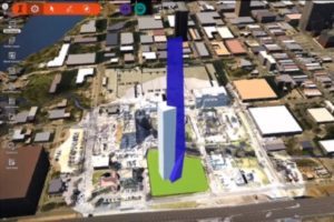
A sound reality capture program as part of your project acquisition strategy, helps your firm win work: Use reality capture as your edge before a project even begins. With a simple scan, you and your firm can integrate actual site features, topographic and terrain data into your proof of concept presentation through the use of Autodesk Infraworks. This allows you to quickly create visualizations to show your potential client what their finished building will look like in context.

Reality capture removes guesswork from the planning process: Rather than depend on time-consuming, manual measurements and surveys, or outdated drawings, project teams can begin the planning process with quality, in-context data. Use the technology to capture the existing site conditions accurately and quickly. These conditions can range from topology and terrain features to existing conditions and features such as roads, utilities and existing structures (both interior and exterior). This makes the planning and iteration process much more streamlined, and the preliminary analysis and visualization process more precise.
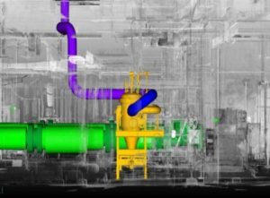
Scans help remove errors from prefabrication process: Use reality capture to validate that the elements fabricated off-site will fit where intended. This verification can be done before getting those elements on site and in the way of operations.
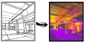
Greatly improves QA/QC processes: Use your scanner and/or UAV system on an ongoing basis to verify that your work, along with the work of other trades ahead of you, is installed to specification. For example, are anchor bolts and weld plates installed in the right locations? Are penetration sleeves and rebar in the correct spots? Documentation along every phase of the project will help you assure quality.
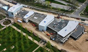
The close-out process becomes more efficient: By documenting your internal and external as-built condition in fine detail before leaving the site, you now have an impressive client handover. The owner will also have a great starting point for seamlessly developing their O&M and lifecycle strategies. And last, the documentation will also help with your firm with future marketing and early stage proposal initiatives.
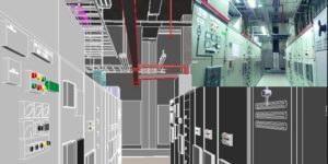
There is a huge time, efficiency, and cost difference between reality capture and traditional measurement methods. UAVs and laser scanning is certainly faster and provides more accurate and more complete data and documentation. But at the end of the day, what matters for AEC project teams is that they have confidence their design is going to work well. Under that light, reality capture technologies provide a tremendous amount of value.
The benefits of reality capture extend beyond this list. Everyone involved in the project can gain from the accuracy and knowledge provided by reality capture technologies and the resulting data. What’s more, the technology is evolving, making reality capture accessible to all. Your needs will depend on the types of projects you execute, and your level of expertise. The options have never been greater, from long-range precision gear that runs rain or shine to small, easily transportable options. initial.aec can help you take the next step to join the many firms getting an edge with reality capture in their tool belt.